
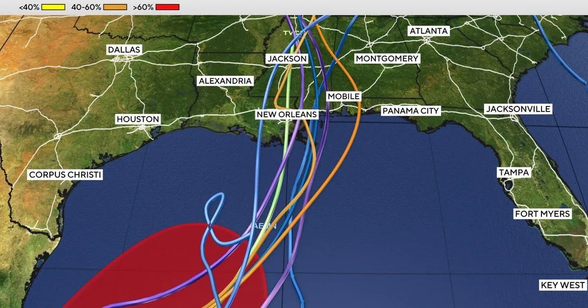
The U.S. National Hurricane Center reported that Tropical Depression Nine formed in the southwestern Gulf of Mexico. Its forecast called for the system to become a tropical storm on Wednesday and a hurricane on Thursday before approaching the northern Gulf Coast.
In its first advisory, issued at 4 p.m. Central time on October 6, the NHC placed the depression about 630 miles southwest of the mouth of the Mississippi River, moving east at roughly five miles per hour. Maximum sustained winds were estimated at about 35 mph. The center forecast that the system would pass north of the Yucatan Peninsula and approach the Gulf Coast by Friday.
The NHC cautioned that the cyclone’s speed and exact track remained uncertain. The forecast cited risks of strong winds, storm surge and heavy rain in parts of the northern Gulf Coast, and urged residents from Louisiana to Florida to monitor updates and prepare their hurricane plans. Strong winds and heavy rain were also possible over western Yucatan.
If the system reaches tropical-storm status, it will be named Isaias. Florida Gov. Ron DeSantis declared an emergency in 25 counties so authorities could prepare for possible impacts in the Panhandle and Big Bend. The forecast did not establish when or where the system might make landfall.